Islamic Maps
Book Details
Format
Hardback or Cased Book
ISBN-10
1851244921
ISBN-13
9781851244928
Publisher
Bodleian Library
Imprint
Bodleian Library
Country of Manufacture
GB
Country of Publication
GB
Publication Date
Oct 18th, 2019
Print length
192 Pages
Weight
1,330 grams
Dimensions
26.60 x 25.70 x 1.80 cms
Product Classification:
Historical maps & atlasesCartography, map-making & projections
AI Summary
Ksh 7,750.00
Werezi Extended Catalogue
Delivery in 14 days
2 copies in stock
Delivery Location
Delivery fee: Select location
Delivery in 14 days
Secure
Quality
Fast
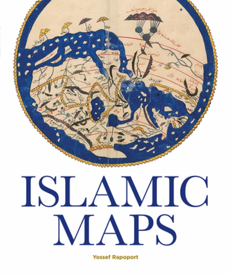
Spanning the Islamic world, from ninth-century Baghdad to nineteenth-century Iran, this book tells the story of the key Muslim map-makers and the art of Islamic cartography. Lavishly illustrated with stunning manuscripts, beautiful instruments and Qibla charts, this book provides a window into the worldviews of Islamic societies.
Get Islamic Maps by at the best price and quality guaranteed only at Werezi Africa's largest book ecommerce store. The book was published by Bodleian Library and it has pages.
Discover books you might love based on this title.
More in This Genre

Reconnoitring Russia
Ksh 3,600.00
Mapping
Ksh 6,100.00
Charles Booth’s London Poverty Maps
Ksh 9,700.00

Mapping the Chinese and Islamic Worlds
Ksh 17,800.00

Mere Green To Little Sutton 1887 - Old Map Supplied Rolled in a Clear Two Part Screw Presentation Tube - Print Size 45cm x 32cm
Ksh 2,350.00

Routledge Revivals: The Atlas of British Railway History (1985)
Ksh 6,650.00
